GIS For Good®
Finding Inspiration in Every Turn
GIS For Good®, founded by RomoGIS, was developed to create change using technology. We train entrepreneurs, advocates, and researchers to leverage GIS for positive impact, equipping them with the skills and tools needed to address critical social challenges. Our commitment to advancing diversity, equity, and community impact worldwide is at the heart of this initiative.
By developing innovative geospatial platforms, we enhance community development, safety, and quality of life. These platforms provide precise, actionable data that informs strategic planning, resource allocation, and community organizing. Whether it’s mapping out inequalities to support advocacy efforts or optimizing emergency response systems to improve public safety, our solutions are designed to create meaningful and lasting change.
This initiative empowers communities with data-driven insights, enabling them to drive sustainable and equitable solutions to social issues. We work closely with local stakeholders to ensure our projects are tailored to their unique needs, fostering a collaborative approach to community development.


GIS For Good® Across the U.S.


.jpg)
GIS For Good® Bronx, New York
We at RomoGIS use GIS in the Bronx to inspire leaders and advocate for social change in communities. Using GIS For Good® in NYC means applying Geographic Information Systems (GIS) for community impact, equity, and justice. It also creates opportunities for the next generation to make a change and to lead. GIS For Good® NYC connects neighborhoods with the tools to map what matters — from food insecurity and gun violence to housing access and youth opportunity. By combining GIS, drones, and community-driven data, we turn local insight into action. Whether it's students using drones to map green space or advocates tracking eviction trends, GIS For Good® helps New Yorkers shape a fairer, more resilient city.
GIS For Good® Detroit, Michigan
GIS For Good® Detroit empowers communities with mapping and drone tools to address issues like gun violence, food insecurity, and environmental injustice. From youth-led STEM projects to hotspot mapping and public health analysis, we're turning neighborhood knowledge into real-world impact. It's data for the people — used by the people — to build a more just Detroit. We also at RomoGIS use GIS to develop leaders that give back to their communities.
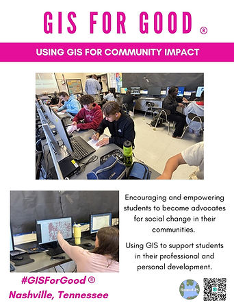
GIS For Good® Nashville, Tennessee
GIS For Good® Nashville brings together mapping, drone tech, and community leadership to tackle real challenges — like housing access, food deserts, and public safety. We train youth and neighbors to use GIS tools to tell their stories, protect their blocks, and build a more just city. It’s about putting powerful tools in local hands — and making change that starts from the ground up. At RomoGIS we teach how mapmaking and GIS can create local change.
GIS For Good® St. Louis, Missouri
At RomoGIS we work alongside residents, schools, and grassroots groups to turn local knowledge into action. From neighborhood surveys to StoryMaps, we’re building tools that reflect the real St. Louis — and helping communities shape what comes next. Whether it's using maps, drones and community- led data we do our best to help the community out. We also use GIS to support emergency management and support services for communities.


GIS For Good® Courses
The focus of RomoGIS is to empower organizations using GIS data. By utilizing the dynamic capabilities of ArcGIS Maps, we enable them to visually explore and analyze various aspects of their communities. Our dedication to community empowerment and social justice is not just a mission but a statement.
Our courses provide you with basic technological skills in the ArcGIS Online platform, QGIS, and Google My Maps. These courses focus on imparting the core principles of GIS mapping data, ensuring that students not only grasp the theoretical aspects but also develop practical expertise in the field. Our goal is for everyone to use this technology to make their community better, as everyone deserves this skill. Enroll in our GIS courses to gain a comprehensive understanding of online mapping using the Esri platform, QGIS, and Google My Maps.
Workshops for Social Impact
RomoGIS offers workshops that focus on the use of GIS for social impact and change. Our team’s experience in community advocacy helps us create customized workshops and applications that support and empower community stakeholders. These workshops cover topics such as mapping of social vulnerabilities, environmental hazards, and other socio-economic factors that contribute to social inequities.
Our workshops emphasize active participation, where community members engage directly with GIS tools and technologies. Participants are immersed in practical exercises that involve collecting, analyzing, and visualizing geospatial data. This hands-on approach not only helps them grasp the theoretical aspects of GIS but also builds their confidence and competence in applying these skills to real-world situations.

Intro to ArcGIS Online

Enroll in our GIS courses to gain a comprehensive understanding of online mapping using the Esri platform. Our courses focus on imparting the core principles of GIS mapping data, ensuring that students not only grasp the theoretical aspects but also develop practical expertise in the field. By the end of the course, participants will be well-versed in leveraging the capabilities of the Esri platform for online mapping, equipping them with valuable skills for various applications in mapping, data analysis, and visualization.
Intro to Google My Maps
Our curriculum extends beyond basic map creation, emphasizing the integration of external data into Google My Maps. Students will gain valuable insights into importing and leveraging external datasets to enhance the richness and relevance of their maps. This advanced skill set empowers students to not only create maps but to tailor them to specific needs, ensuring a personalized and impactful visual representation. By the end of the course, participants will have a comprehensive skill set, enabling them to navigate the Google My Maps interface, create personalized maps, integrate external data seamlessly, and design custom web maps to meet diverse needs.

Intro to Survey 123
Join our course where we guide students through the process of formatting online applications using Survey123, a powerful tool for creating surveys and applications. Throughout the program, participants will gain hands-on experience in crafting online applications and surveys with a focus on creating a seamless and user-friendly interface. Additionally, we delve into the practical aspect of translating survey results into dynamic maps. Participants will receive comprehensive training on creating maps that effectively visualize and communicate the data collected through surveys. Our course emphasizes practical skills, ensuring that students not only understand the theoretical concepts but also acquire the proficiency to implement them in real-world scenarios.